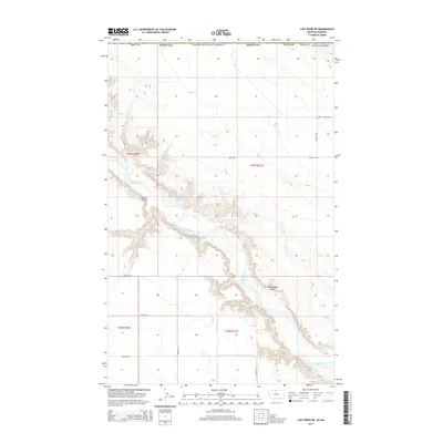
2014 Map of Lost River NE
USGS Topo · Published 2014About this map
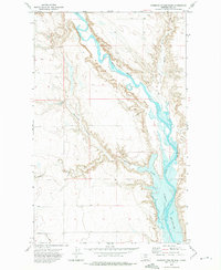
The Milk River meanders deeply through this northern Hill County landscape, carving a complex network of breaks and drainages into the high plains. This 2014 survey captures the geographic isolation of the region near the international border, where the terrain is defined by prominent landmarks like Rattlesnake Butte and the elevation of Spring Coulee Ridge. The area is characterized by large-scale agricultural and ranching divisions, with a strictly rectangular grid of section lines and gravel paths such as Road 270 N and Road 195 N providing the only overland access. The course of the Spring Coulee and the river valley below it demonstrate the persistent erosion patterns that shape this remote corner of Montana, highlighting how the natural hydrology dictates the layout of regional infrastructure.
Find a feature on this map
19 named features on this map. Tap any name to fly to it.
Don’t see what you’re looking for? This feature index may not catch every label — zoom into the map to look around manually.
Map Details
Editions of this 2014 Lost River NE Map
This is the sole edition of this map. No revisions or reprints were ever made.
Other maps of this area

1920 · Gildford
USGS Topo · 1:125,000

1943 · Gildford
USGS Topo · 1:125,000

1954 · Shelby
USGS Topo · 1:250,000

1958 · Shelby
USGS Topo · 1:250,000
1972 · Lost River NE
USGS Topo · 1:24,000

1972 · Mc Kinnsey Reservoir East
USGS Topo · 1:24,000
1972 · Ninemile Coulee West
USGS Topo · 1:24,000
1972 · Lost River
USGS Topo · 1:24,000
1972 · Ninemile Coulee East
USGS Topo · 1:24,000
1984 · Chester
USGS Topo · 1:100,000