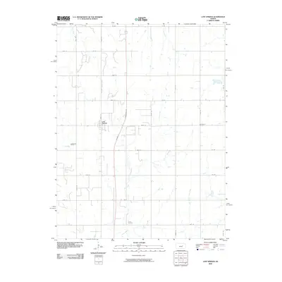
2009 Map of Lost Springs
USGS Topo · Published 2009About this map
Lost Springs serves as the primary focal point in this central Kansas landscape, situated at the intersection of US Hwy 56 and Wagonwheel Rd. The area is characterized by a grid-like network of rural roads that traverse the drainage basins of Lyon Creek, Kohls Creek, and Clear Creek. To the west of the town center lies the Lost Springs Oil Field, signaling the area's industrial history. Genealogists will find interest in the documented locations of Old Mission Cemetery and Hartke Cemetery, which are nestled among the agricultural fields. The terrain is defined by the subtle movement of several water bodies, including Lime Creek and the East Branch Clear Creek, which flow through the prairie, shaping the development of local farmsteads and transport routes such as Trail Rd.
Find a feature on this map
36 named features on this map. Tap any name to fly to it.
Don’t see what you’re looking for? This feature index may not catch every label — zoom into the map to look around manually.
Map Details
Editions of this 2009 Lost Springs Map
This is the sole edition of this map. No revisions or reprints were ever made.
Other maps of this area

1889 · Newton
USGS Topo · 1:125,000

1889 · Abilene
USGS Topo · 1:125,000

1889 · Parkerville
USGS Topo · 1:125,000

1894 · Newton
USGS Topo · 1:125,000

1894 · Abilene
USGS Topo · 1:125,000

1894 · Parkerville
USGS Topo · 1:125,000

1898 · Cottonwood Falls
USGS Topo · 1:125,000

1955 · Hutchinson
USGS Topo · 1:250,000

1959 · Hutchinson
USGS Topo · 1:250,000

1964 · Ramona
USGS Topo · 1:24,000