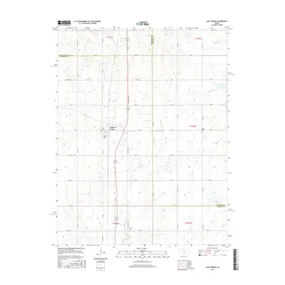
2015 Map of Lost Springs
USGS Topo · Published 2015About this map
Lost Springs serves as the focal point of this rural prairie landscape, positioned where the boundaries of Dickinson, Morris, and Marion counties converge. The settlement is defined by its grid of local streets like Main St and Berry St, surrounded by a vast network of section-line roads that follow the township and range survey system. This area is heavily drained by a series of waterways, including Lyon Creek and Kohls Creek to the west, and the various branches of Clear Creek and Middle Creek to the east. Local history and genealogy are preserved in several distinct burial grounds, such as the Swedish Mission Cem and the Lost Springs Cem, which reflect the early ethnic and social foundations of these plains communities.
Find a feature on this map
54 named features on this map. Tap any name to fly to it.
Don’t see what you’re looking for? This feature index may not catch every label — zoom into the map to look around manually.
Map Details
Editions of this 2015 Lost Springs Map
This is the sole edition of this map. No revisions or reprints were ever made.
Other maps of this area

1889 · Newton
USGS Topo · 1:125,000

1889 · Abilene
USGS Topo · 1:125,000

1889 · Parkerville
USGS Topo · 1:125,000

1894 · Newton
USGS Topo · 1:125,000

1894 · Abilene
USGS Topo · 1:125,000

1894 · Parkerville
USGS Topo · 1:125,000

1898 · Cottonwood Falls
USGS Topo · 1:125,000

1955 · Hutchinson
USGS Topo · 1:250,000

1959 · Hutchinson
USGS Topo · 1:250,000

1964 · Ramona
USGS Topo · 1:24,000