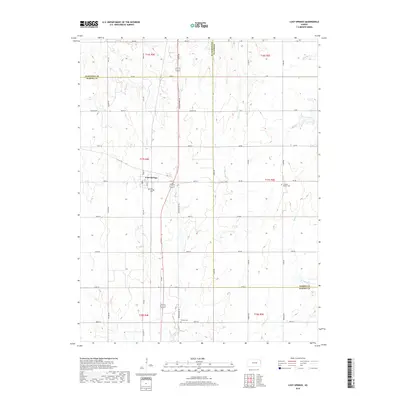
2018 Map of Lost Springs
USGS Topo · Published 2018About this map
The small town of Lost Springs sits at the center of this rural landscape where the borders of Marion, Dickinson, and Morris Counties meet. A network of sectional roads like Wagonwheel Rd and Upland Rd defines the agricultural grid, interrupted only by the winding paths of local waterways including Lyon Cr and Kohls Cr. This 2018 survey reveals the persistent presence of early regional history through its marked burial grounds, such as the Swedish Mission Cem to the east and the Lost Springs Cem near the town site. The map captures the quiet character of the Kansas prairie, showing how the landscape is segmented into townships and ranges like t17s r4e, while the headwaters of numerous creeks—including Sixmile Cr and Middle Cr—drain the surrounding fields.
Find a feature on this map
54 named features on this map. Tap any name to fly to it.
Don’t see what you’re looking for? This feature index may not catch every label — zoom into the map to look around manually.
Map Details
Editions of this 2018 Lost Springs Map
This is the sole edition of this map. No revisions or reprints were ever made.
Other maps of this area

1889 · Newton
USGS Topo · 1:125,000

1889 · Abilene
USGS Topo · 1:125,000

1889 · Parkerville
USGS Topo · 1:125,000

1894 · Newton
USGS Topo · 1:125,000

1894 · Abilene
USGS Topo · 1:125,000

1894 · Parkerville
USGS Topo · 1:125,000

1898 · Cottonwood Falls
USGS Topo · 1:125,000

1955 · Hutchinson
USGS Topo · 1:250,000

1959 · Hutchinson
USGS Topo · 1:250,000

1964 · Ramona
USGS Topo · 1:24,000