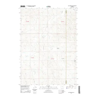
2015 Map of Lost Springs NW
USGS Topo · Published 2015About this map
The boundary between Converse Co and Niobrara Co runs north-to-south through this high plains landscape, defined by a network of seasonal drainages and cattle-country roads. This region of Wyoming is marked by its deep draws and ephemeral creeks, including the winding Twentymile Cr and Harney Cr systems. Historically significant for its open-range ranching, the area's geography is traced by landmarks such as Baby Springs Draw, Flat Top Draw, and the distinctive Dumbell Rock Draw. Transport through this arid terrain relies on established routes like Manning Rd and Twenty Mile Rd, which connect the scattered sections of the Public Land Survey System, specifically t35n r67w and t34n r68w.
Find a feature on this map
20 named features on this map. Tap any name to fly to it.
Don’t see what you’re looking for? This feature index may not catch every label — zoom into the map to look around manually.
Map Details
Editions of this 2015 Lost Springs NW Map
This is the sole edition of this map. No revisions or reprints were ever made.
Other maps of this area

1954 · Torrington
USGS Topo · 1:250,000

1955 · Newcastle
USGS Topo · 1:250,000

1958 · Torrington
USGS Topo · 1:250,000

1958 · Newcastle
USGS Topo · 1:250,000

1970 · Lost Springs
USGS Topo · 1:24,000
1970 · The Park
USGS Topo · 1:24,000

1970 · Bill 4 SE
USGS Topo · 1:24,000

1970 · Walker Creek School
USGS Topo · 1:24,000

1970 · Lost Springs NW
USGS Topo · 1:24,000

1970 · Cooley Draw
USGS Topo · 1:24,000