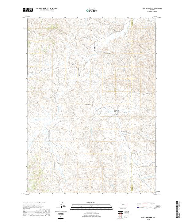
2021 Map of Lost Springs NW
USGS Topo · Published 2021About this map
Twentymile Cr and its tributaries define the drainage patterns of this high plains landscape along the Converse and Niobrara County line. The map reveals a highly dissected terrain characterized by numerous draws, including Baby Springs Draw, Flat Top Draw, and the uniquely named Dumbell Rock Draw. These features suggest a landscape shaped by seasonal water flow, where land use is tied closely to the available water sources like Spring Br Harney Cr and W Harney Cr. Transportation is limited to a sparse network of rural routes such as Co Rd 53 and Twenty Mile Creek Rd, which follow the natural contours and valley floors. This 2021 survey by the U.S. Geological Survey provides an intricate look at the hydrology of the region, including the headwaters of Cottonwood Cr and the convergence of E Harney Cr and Harney Cr.
Find a feature on this map
19 named features on this map. Tap any name to fly to it.
Don’t see what you’re looking for? This feature index may not catch every label — zoom into the map to look around manually.
Map Details
Editions of this 2021 Lost Springs NW Map
This is the sole edition of this map. No revisions or reprints were ever made.
Other maps of this area

1954 · Torrington
USGS Topo · 1:250,000

1955 · Newcastle
USGS Topo · 1:250,000

1958 · Torrington
USGS Topo · 1:250,000

1958 · Newcastle
USGS Topo · 1:250,000

1970 · Lost Springs
USGS Topo · 1:24,000
1970 · The Park
USGS Topo · 1:24,000

1970 · Bill 4 SE
USGS Topo · 1:24,000

1970 · Walker Creek School
USGS Topo · 1:24,000

1970 · Lost Springs NW
USGS Topo · 1:24,000

1970 · Cooley Draw
USGS Topo · 1:24,000