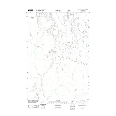
2011 Map of Lost Trail Pass
USGS Topo · Published 2011About this map
Chief Joseph Pass and Gibbons Pass anchor this high-altitude landscape along the Continental Divide, where the borders of Montana and Idaho meet. The 2011 survey illustrates a region defined by recreational development and historical transit corridors, including the Lost Trail Sports Area and the Lost Trail Pass Picnic Area. A complex network of drainage systems, such as the North Fork Salmon River and Moose Creek, carve through the terrain between Lewis and Clark Ridge and Saddle Mountain. Local landmarks like Cool Gulch and the Saddle Mountain Fire Area Point of Interest reflect the environmental management and natural history of the Bitterroot and Salmon-Challis national forest lands. For those tracing the geography of early western exploration, the presence of the ridge named for the Corps of Discovery provides a modern link to the historic 1805-1806 crossing routes used by Lewis and Clark.
Find a feature on this map
34 named features on this map. Tap any name to fly to it.
Don’t see what you’re looking for? This feature index may not catch every label — zoom into the map to look around manually.
Map Details
Editions of this 2011 Lost Trail Pass Map
This is the sole edition of this map. No revisions or reprints were ever made.
Other maps of this area

1955 · Dillon
USGS Topo · 1:250,000

1956 · Elk City
USGS Topo · 1:250,000

1957 · Dillon
USGS Topo · 1:250,000

1958 · Dillon
USGS Topo · 1:250,000

1960 · Elk City
USGS Topo · 1:250,000

1960 · Piquett Mountain
USGS Topo · 1:62,500

1962 · Dillon
USGS Topo · 1:250,000

1965 · Dillon
USGS Topo · 1:250,000

1965 · Medicine Hot Springs
USGS Topo · 1:24,000

1966 · Lost Trail Pass
USGS Topo · 1:24,000