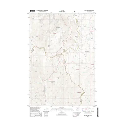
2014 Map of Lost Trail Pass
USGS Topo · Published 2014About this map
Lost Trail Pass and Chief Joseph Pass serve as the primary gateways across the Continental Divide on this 2014 survey of the high country straddling the Montana and Idaho border. The terrain is defined by the intersections of the Bitterroot National Forest, Beaverhead National Forest, and Salmon National Forest. This landscape is marked by historical transit corridors including Lewis and Clark Ridge and the old Gibbons Pass Rd, following the path through Gibbons Pass. Water is a defining feature of these slopes, from the headwaters of the N Fork Salmon River and W Fork N Fork Salmon River to named points like Gallogly Spring and Cool Gulch. The complex political geography is visible in the converging lines of Ravalli, Beaverhead, and Lemhi counties, showing how modern US Hwy 93 navigates these established mountain crossings.
Find a feature on this map
49 named features on this map. Tap any name to fly to it.
Don’t see what you’re looking for? This feature index may not catch every label — zoom into the map to look around manually.
Map Details
Editions of this 2014 Lost Trail Pass Map
This is the sole edition of this map. No revisions or reprints were ever made.
Other maps of this area

1955 · Dillon
USGS Topo · 1:250,000

1956 · Elk City
USGS Topo · 1:250,000

1957 · Dillon
USGS Topo · 1:250,000

1958 · Dillon
USGS Topo · 1:250,000

1960 · Elk City
USGS Topo · 1:250,000

1960 · Piquett Mountain
USGS Topo · 1:62,500

1962 · Dillon
USGS Topo · 1:250,000

1965 · Dillon
USGS Topo · 1:250,000

1965 · Medicine Hot Springs
USGS Topo · 1:24,000

1966 · Lost Trail Pass
USGS Topo · 1:24,000