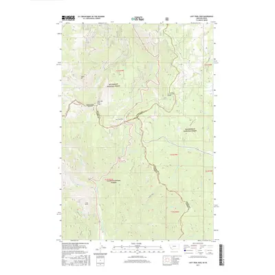
2017 Map of Lost Trail Pass
USGS Topo · Published 2017About this map
Lost Trail Pass serves as the central hub of this rugged borderland, where the Montana-Idaho state line meets the Continental Divide. This 2017 survey documents the intersection of three major federal lands: the Bitterroot National Forest, Beaverhead National Forest, and Salmon National Forest. The landscape is defined by its significance to early exploration, marked clearly by the Lewis and Clark Ridge spanning the western heights. Drainage patterns here are complex, feeding both the N Fork Salmon River to the south and numerous creeks like Trail Cr and Prairie Cr to the north. Notable local landmarks include Gallogly Hot Springs and the prominent Saddle Mtn, while the historical transit through the mountains is preserved in routes such as Gibbons Pass Rd and Anderson Mtn Rd.
Find a feature on this map
48 named features on this map. Tap any name to fly to it.
Don’t see what you’re looking for? This feature index may not catch every label — zoom into the map to look around manually.
Map Details
Editions of this 2017 Lost Trail Pass Map
This is the sole edition of this map. No revisions or reprints were ever made.
Other maps of this area

1955 · Dillon
USGS Topo · 1:250,000

1956 · Elk City
USGS Topo · 1:250,000

1957 · Dillon
USGS Topo · 1:250,000

1958 · Dillon
USGS Topo · 1:250,000

1960 · Elk City
USGS Topo · 1:250,000

1960 · Piquett Mountain
USGS Topo · 1:62,500

1962 · Dillon
USGS Topo · 1:250,000

1965 · Dillon
USGS Topo · 1:250,000

1965 · Medicine Hot Springs
USGS Topo · 1:24,000

1966 · Lost Trail Pass
USGS Topo · 1:24,000