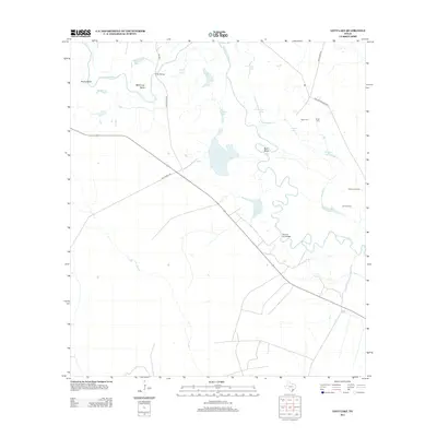
2013 Map of Lott Lake
USGS Topo · Published 2013About this map
The San Antonio River snakes through the coastal plains of Goliad County, carving out significant landforms like Hovey Bend, McKinney Bend, and Burn Bend. This South Texas landscape is defined by its complex hydrology, where numerous oxbow lakes and seasonal basins such as Lott Lake, Rice Lake, and Fagan Lake dot the river corridor. The presence of the Gaffney Oil Field indicates the region's continuing reliance on petroleum extraction, while rural infrastructure is represented by crossings like Duke Bridge and the Simms Footbridge. For those researching local heritage, the map identifies several family-named burial grounds, including Fagan Cem, Terrell Cem, and Sample Cem, often located near the historical transport routes of Duke Ranch Rd and Matthews Rd.
Find a feature on this map
26 named features on this map. Tap any name to fly to it.
Don’t see what you’re looking for? This feature index may not catch every label — zoom into the map to look around manually.
Map Details
Editions of this 2013 Lott Lake Map
This is the sole edition of this map. No revisions or reprints were ever made.
Other maps of this area

1953 · Beeville
USGS Topo · 1:250,000

1954 · Vidaurri
USGS Topo · 1:62,500

1954 · Refugio
USGS Topo · 1:62,500

1956 · Beeville
USGS Topo · 1:250,000

1960 · Beeville
USGS Topo · 1:250,000

1962 · Live Oak Lake
USGS Topo · 1:24,000

1962 · Fannin
USGS Topo · 1:24,000

1962 · Lott Lake
USGS Topo · 1:24,000

1962 · McFaddin
USGS Topo · 1:24,000

1962 · Hensley Lake
USGS Topo · 1:24,000