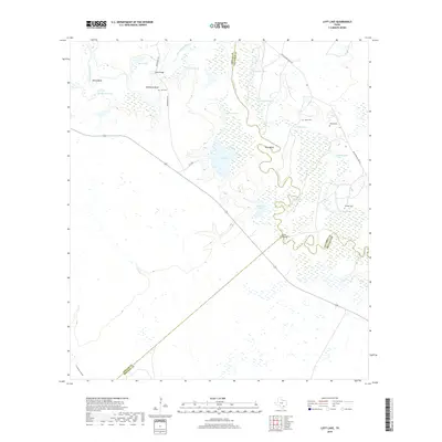
2019 Map of Lott Lake
USGS Topo · Published 2019About this map
The San Antonio River meanders through a landscape defined by an intricate network of wetlands and oxbow lakes on this coastal plain survey. The river's winding course forms distinct points of interest like Hovey Bend, McKinney Bend, and Barn Bend, which dictate the local topography and historical property boundaries between Goliad, Victoria, and Refugio counties. Small rural cemeteries, including Lott Cem, Fagan Cem, Terrell Cem, and Sample Cem, are scattered across the terrain, serving as primary anchors for genealogical research in this sparsely settled area. Essential crossings like Duke Bridge and the Simms Footbridge provide critical connections over the waterways and through the low-lying reaches of Cottonwood Hollow. The abundance of named water bodies such as Rice Lake, Summers Lake, and Lott Lake illustrates the seasonal flood patterns that have long influenced ranching and land use in this part of Texas.
Find a feature on this map
29 named features on this map. Tap any name to fly to it.
Don’t see what you’re looking for? This feature index may not catch every label — zoom into the map to look around manually.
Map Details
Editions of this 2019 Lott Lake Map
This is the sole edition of this map. No revisions or reprints were ever made.
Other maps of this area

1953 · Beeville
USGS Topo · 1:250,000

1954 · Vidaurri
USGS Topo · 1:62,500

1954 · Refugio
USGS Topo · 1:62,500

1956 · Beeville
USGS Topo · 1:250,000

1960 · Beeville
USGS Topo · 1:250,000

1962 · Live Oak Lake
USGS Topo · 1:24,000

1962 · Fannin
USGS Topo · 1:24,000

1962 · Lott Lake
USGS Topo · 1:24,000

1962 · McFaddin
USGS Topo · 1:24,000

1962 · Hensley Lake
USGS Topo · 1:24,000