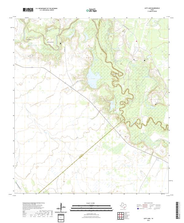
2022 Map of Lott Lake
USGS Topo · Published 2022About this map
The San Antonio River carves a winding path through this corner of South Texas, defining the boundary between Goliad and Victoria counties. The river valley is a complex network of oxbow lakes and wetlands, including Lott Lake, Rice Lake, and Hardaman Lake. Notable bends such as Hovey Bend, McKinney Bend, and Burn Bend illustrate the shifting nature of the river channel over time.
Find a feature on this map
27 named features on this map. Tap any name to fly to it.
Don’t see what you’re looking for? This feature index may not catch every label — zoom into the map to look around manually.
Map Details
Editions of this 2022 Lott Lake Map
This is the sole edition of this map. No revisions or reprints were ever made.
Other maps of this area

1953 · Beeville
USGS Topo · 1:250,000

1954 · Vidaurri
USGS Topo · 1:62,500

1954 · Refugio
USGS Topo · 1:62,500

1956 · Beeville
USGS Topo · 1:250,000

1960 · Beeville
USGS Topo · 1:250,000

1962 · Live Oak Lake
USGS Topo · 1:24,000

1962 · Fannin
USGS Topo · 1:24,000

1962 · Lott Lake
USGS Topo · 1:24,000

1962 · McFaddin
USGS Topo · 1:24,000

1962 · Hensley Lake
USGS Topo · 1:24,000