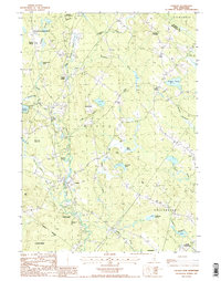
1987 Map of Loudon
USGS Topo · Published 1987About this map
Shaker Village and the surrounding woodlands of Shaker State Forest anchor the northwestern reaches of this terrain, where small cemeteries and rural outposts like Pearls Corner mark the landscape. The geography is defined by a complex network of waterways, including Shaker Brook and Bumfagon Brook, which feed into the central Soucook River valley. This 1980s data highlights the transition from traditional agricultural and forestry land use to more contemporary features, as seen in the several Sand Pits and Gravel Pits scattered near the riverbanks.
Find a feature on this map
43 named features on this map. Tap any name to fly to it.
Don’t see what you’re looking for? This feature index may not catch every label — zoom into the map to look around manually.
Map Details
Editions of this 1987 Loudon Map
2 editions found
Other maps of this area

1919 · Gilmanton
USGS Topo · 1:62,500

1921 · Suncook
USGS Topo · 1:62,500

1927 · Concord
USGS Topo · 1:62,500

1927 · Penacook
USGS Topo · 1:62,500

1927 · Gilmanton
USGS Topo · 1:62,500

1944 · Suncook
USGS Topo · 1:62,500

1949 · Portland
USGS Topo · 1:250,000

1949 · Concord
USGS Topo · 1:62,500

1956 · Penacook
USGS Topo · 1:62,500

1956 · Portland
USGS Topo · 1:250,000