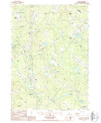
1987 Map of Loudon
USGS Topo · Published 1987About this map
The historic Shaker Village and the adjacent Shaker State Forest anchor the northwestern reaches of this Merrimack County landscape. The area is defined by the winding course of the Soucook River, which supports local industry and natural preserves like the Soucook River State Forest. Traditional village centers including Loudon, Loudon Center, and North Chichester are mapped in detail, reflecting a rural New Hampshire settlement pattern of small community clusters connected by a dense network of brooks such as Academy Brook and Bumfagon Brook.
Find a feature on this map
48 named features on this map. Tap any name to fly to it.
Don’t see what you’re looking for? This feature index may not catch every label — zoom into the map to look around manually.
Map Details
Editions of this 1987 Loudon Map
2 editions found
Other maps of this area

1919 · Gilmanton
USGS Topo · 1:62,500

1921 · Suncook
USGS Topo · 1:62,500

1927 · Concord
USGS Topo · 1:62,500

1927 · Penacook
USGS Topo · 1:62,500

1927 · Gilmanton
USGS Topo · 1:62,500

1944 · Suncook
USGS Topo · 1:62,500

1949 · Portland
USGS Topo · 1:250,000

1949 · Concord
USGS Topo · 1:62,500

1956 · Penacook
USGS Topo · 1:62,500

1956 · Portland
USGS Topo · 1:250,000