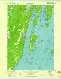
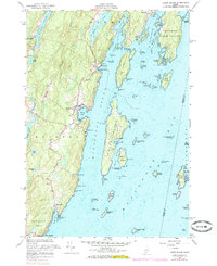
1955 Map of Louds Island
USGS Topo · Published 1959About this map
Muscongus Sound and the intricate waters of Muscongus Bay define this mid-1950s coastal landscape, where the seafaring history of the Maine coast is written in its many islands and sheltered harbors. The isolated settlement of Loudville on Louds Island stands as a focal point of the island economy, supported by the Loudville Cem and the nearby Marsh Harbor. On the mainland, the village of Round Pond serves as a protected anchorage, while State Route 32 threads through settlements like Muscongus and Chamberlain. The map documents a time when maritime trade and local fishing were the primary drivers of the region, evidenced by the numerous named ledges and passages like Flying Passage and Hockomock Channel that required precise navigation. From the freshwater of Biscay Pond to the granite workings at the Quarry, the terrain shows a blend of coastal agriculture and small-scale industry.
Find a feature on this map
85 named features on this map. Tap any name to fly to it.
Don’t see what you’re looking for? This feature index may not catch every label — zoom into the map to look around manually.
Map Details
Editions of this 1955 Louds Island Map
5 editions found
Other maps of this area

1893 · Wiscasset
USGS Topo · 1:62,500

1893 · Boothbay
USGS Topo · 1:62,500

1904 · Monhegan
USGS Topo · 1:62,500

1906 · Monhegan
USGS Topo · 1:62,500

1913 · Waldoboro
USGS Topo · 1:48,000

1915 · Waldoboro
USGS Topo · 1:62,500

1941 · Waldoboro
USGS Topo · 1:62,500

1941 · Boothbay
USGS Topo · 1:62,500

1943 · Boothbay
USGS Topo · 1:62,500

1944 · Wiscasset
USGS Topo · 1:62,500