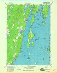
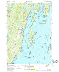
1955 Map of Louds Island
USGS Topo · Published 1969About this map
Louds Island and the surrounding coastal waters of Muscongus Bay define this mid-coast Maine landscape during the mid-1950s. The village of Loudville sits at the heart of the island, which is separated from the mainland by the deep waters of Muscongus Sound. On the western shore, the Pemaquid Neck peninsula is home to the established settlements of New Harbor, Chamberlain, and Round Pond. The map reveals a working maritime and land-based economy, marked by several quarries, borrow pits, and a Boathouse at Muscongus Harbor. Genealogists will find notable sites such as Ocean Hill Cem and Maple Grove Cem, alongside multiple smaller cemeteries scattered near Round Pond. The intricate coastline is dotted with numerous landforms like Keene Neck, Bremen Long Island, and Hungry Island, illustrating the complex navigation required through Keene Narrows and Hockomock Channel.
Find a feature on this map
89 named features on this map. Tap any name to fly to it.
Don’t see what you’re looking for? This feature index may not catch every label — zoom into the map to look around manually.
Map Details
Editions of this 1955 Louds Island Map
5 editions found
Other maps of this area

1893 · Wiscasset
USGS Topo · 1:62,500

1893 · Boothbay
USGS Topo · 1:62,500

1904 · Monhegan
USGS Topo · 1:62,500

1906 · Monhegan
USGS Topo · 1:62,500

1913 · Waldoboro
USGS Topo · 1:48,000

1915 · Waldoboro
USGS Topo · 1:62,500

1941 · Waldoboro
USGS Topo · 1:62,500

1941 · Boothbay
USGS Topo · 1:62,500

1943 · Boothbay
USGS Topo · 1:62,500

1944 · Wiscasset
USGS Topo · 1:62,500