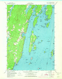
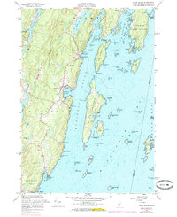
1955 Map of Louds Island
USGS Topo · Published 1974About this map
Louds Island and the neighboring Bremen Long Island dominate the waters of Muscongus Bay in this mid-century coastal survey. The map details a landscape defined by saltwater channels like Hockomock Channel and land-bound water bodies such as Biscay Pond and Webber Pond. Settlement is concentrated in small coastal villages including Round Pond, Muscongus, and Loudville, where local genealogy is anchored by sites like the Loudville Cem and Maple Grove Cem. The interior shows a working landscape of quarries, borrow pits, and ruins, suggesting an era of transition for these mid-coast Maine communities. Navigational hazards such as Killick Stone Island and Thrumcap Island are meticulously noted alongside the complex seafloor contours of the Muscongus Sound, reflecting the deep maritime heritage of Lincoln County.
Find a feature on this map
83 named features on this map. Tap any name to fly to it.
Don’t see what you’re looking for? This feature index may not catch every label — zoom into the map to look around manually.
Map Details
Editions of this 1955 Louds Island Map
5 editions found
Other maps of this area

1893 · Wiscasset
USGS Topo · 1:62,500

1893 · Boothbay
USGS Topo · 1:62,500

1904 · Monhegan
USGS Topo · 1:62,500

1906 · Monhegan
USGS Topo · 1:62,500

1913 · Waldoboro
USGS Topo · 1:48,000

1915 · Waldoboro
USGS Topo · 1:62,500

1941 · Waldoboro
USGS Topo · 1:62,500

1941 · Boothbay
USGS Topo · 1:62,500

1943 · Boothbay
USGS Topo · 1:62,500

1944 · Wiscasset
USGS Topo · 1:62,500