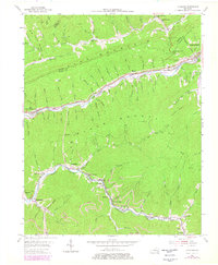
1954 Map of Louellen
USGS Topo · Published 1978About this map
The rugged coal and timber landscape of the Letcher and Harlan County border is defined here by the steep ridges of Pine Mountain and Black Mountain. In the mid-1950s, the economic life of the region followed the Cumberland River and Clover Fork, where a string of mining and rail towns—including Highsplint, Closplint, and Louellen—nestled in the narrow valley floors. The L & N Railroad serves as the industrial spine, with lines like the Louisville and Nashville connecting remote spurs to larger hubs.
Find a feature on this map
104 named features on this map. Tap any name to fly to it.
Don’t see what you’re looking for? This feature index may not catch every label — zoom into the map to look around manually.
Map Details
Editions of this 1954 Louellen Map
4 editions found
Other maps of this area

1887 · Jonesville
USGS Topo · 1:125,000

1890 · Whitesburg
USGS Topo · 1:125,000

1891 · Hazard
USGS Topo · 1:125,000

1891 · Jonesville
USGS Topo · 1:125,000

1892 · Whitesburg
USGS Topo · 1:125,000

1894 · Estillville
USGS Topo · 1:125,000

1913 · Oven Fork
USGS Topo · 1:48,000

1915 · Whitesburg
USGS Topo · 1:62,500

1916 · Cornettsville
USGS Topo · 1:62,500

1916 · Nolansburg
USGS Topo · 1:48,000