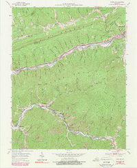
1954 Map of Louellen
USGS Topo · Published 1982About this map
Black Mountain and Pine Mountain dominate this 1950s Kentucky landscape, where coal mining and rail transport shaped the narrow valleys of Harlan and Letcher Counties. The L & N railroad threads along the Poor Fork and the Cumberland River, serving a string of company towns and mining settlements including Louellen, Highsplint, Closplint, and Cumberland. The dense distribution of cemeteries such as Riddle Cem and Kelly Cem, alongside community institutions like Mill Branch Ch and Huff Sch, reveals the deep-rooted family genealogies of the Appalachian coalfields. Evidence of industrial activity is clear through the presence of Strip Mined areas and local quarries, showing how the local economy integrated with the steep terrain. These settlements, often tucked into hollows like Stobo Hollow, were connected by a network of state routes including KY 160 and KY 119 during an era of significant regional production.
Find a feature on this map
100 named features on this map. Tap any name to fly to it.
Don’t see what you’re looking for? This feature index may not catch every label — zoom into the map to look around manually.
Map Details
Editions of this 1954 Louellen Map
4 editions found
Other maps of this area

1887 · Jonesville
USGS Topo · 1:125,000

1890 · Whitesburg
USGS Topo · 1:125,000

1891 · Hazard
USGS Topo · 1:125,000

1891 · Jonesville
USGS Topo · 1:125,000

1892 · Whitesburg
USGS Topo · 1:125,000

1894 · Estillville
USGS Topo · 1:125,000

1913 · Oven Fork
USGS Topo · 1:48,000

1915 · Whitesburg
USGS Topo · 1:62,500

1916 · Cornettsville
USGS Topo · 1:62,500

1916 · Nolansburg
USGS Topo · 1:48,000