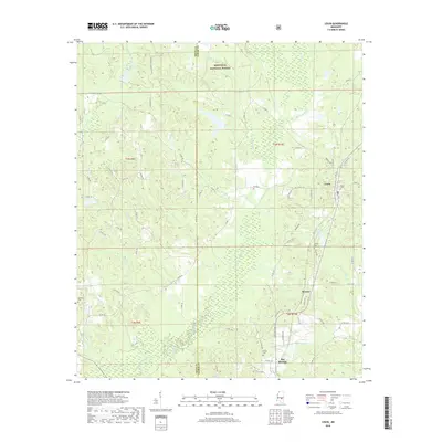
2018 Map of Louin
USGS Topo · Published 2018About this map
Bienville National Forest dominates the northern reaches of this landscape, where the headwaters of the W Tallahala Cr and Gammage Cr begin their descent south toward the Gulf. The boundary between Smith and Jasper counties bisects the terrain, creating a transition between protected forest lands and the rural agricultural and timber tracts surrounding Louin and Bay Springs. The settlement pattern follows the high ground between the numerous creek branches, such as Rosson Br and Buchanan Br, which feed the larger Tallahala Creek system.
Find a feature on this map
73 named features on this map. Tap any name to fly to it.
Don’t see what you’re looking for? This feature index may not catch every label — zoom into the map to look around manually.
Map Details
Editions of this 2018 Louin Map
This is the sole edition of this map. No revisions or reprints were ever made.
Other maps of this area

1953 · Hattiesburg
USGS Topo · 1:250,000

1953 · Meridian
USGS Topo · 1:250,000

1957 · Meridian
USGS Topo · 1:250,000

1958 · Hattiesburg
USGS Topo · 1:250,000

1964 · Lake Como
USGS Topo · 1:24,000

1965 · Meridian
USGS Topo · 1:250,000

1968 · Clear Springs
USGS Topo · 1:24,000

1968 · Pineville
USGS Topo · 1:24,000

1968 · Louin
USGS Topo · 1:24,000

1968 · Louin SW
USGS Topo · 1:24,000