
1968 Map of Louin SW
USGS Topo · Published 1970About this map
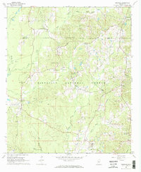
The Bienville National Forest dominates the northern reaches of this landscape, where the Leaf River carves a winding path southward through Smith County. This late 1960s survey captures a rural Mississippi terrain defined by family-named hills like Morgan Hill and Flat Rock Hill, and a scattered network of country churches and burial grounds that serve as vital markers for local genealogy. Settlements like Sylvarena and the edge of Raleigh anchor the road system, while the presence of several Oil Wells and a Gravel Pit indicates the active extraction industries of the era. The mapping of Wadell Cave and several spring-fed waters, including Spring Lakes, highlights the natural hydrology that shaped early settlement patterns. For researchers, the map provides precise locations for community centers such as Christian Chapel, Trinity Ch, and the Cedar Grove Ch Cem, offering a clear view of the area's social and spiritual geography.
Find a feature on this map
39 named features on this map. Tap any name to fly to it.
Don’t see what you’re looking for? This feature index may not catch every label — zoom into the map to look around manually.
Map Details
Editions of this 1968 Louin SW Map
This is the sole edition of this map. No revisions or reprints were ever made.
Other maps of this area

1953 · Hattiesburg
USGS Topo · 1:250,000

1953 · Meridian
USGS Topo · 1:250,000

1957 · Meridian
USGS Topo · 1:250,000

1958 · Hattiesburg
USGS Topo · 1:250,000

1965 · Meridian
USGS Topo · 1:250,000

1968 · Clear Springs
USGS Topo · 1:24,000

1968 · Pineville
USGS Topo · 1:24,000
1968 · Homewood
USGS Topo · 1:24,000

1968 · Raleigh
USGS Topo · 1:24,000

1968 · Louin
USGS Topo · 1:24,000