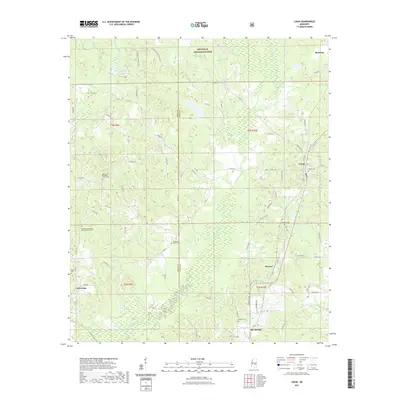
2021 Map of Louin
USGS Topo · Published 2021About this map
The Bienville National Forest dominates the northern reaches of this landscape, where the boundary between Smith and Jasper counties intersects a network of rural roads and timberland. This 2021 survey documents the established settlements of Louin, Montrose, Sylvarena, and the northern edge of Bay Springs. For those tracing local heritage, the map is punctuated by numerous rural congregations and resting places, such as Warren Hill Methodist Church Cem and Hopewell Missionary Baptist Church Cem. The terrain is defined by a dense hydrographic network, including W Tallahala Cr and Thompson Br, which flow through the undulating pine forests. The inclusion of modern landmarks like Pineview Lake and Greenfree Reservoir alongside family-named cemeteries like Holden Cem and Bethel Cem provides a clear view of the area's contemporary geography and its deep historical roots.
Find a feature on this map
80 named features on this map. Tap any name to fly to it.
Don’t see what you’re looking for? This feature index may not catch every label — zoom into the map to look around manually.
Map Details
Editions of this 2021 Louin Map
This is the sole edition of this map. No revisions or reprints were ever made.
Other maps of this area

1953 · Hattiesburg
USGS Topo · 1:250,000

1953 · Meridian
USGS Topo · 1:250,000

1957 · Meridian
USGS Topo · 1:250,000

1958 · Hattiesburg
USGS Topo · 1:250,000

1964 · Lake Como
USGS Topo · 1:24,000

1965 · Meridian
USGS Topo · 1:250,000

1968 · Clear Springs
USGS Topo · 1:24,000

1968 · Pineville
USGS Topo · 1:24,000

1968 · Louin
USGS Topo · 1:24,000

1968 · Louin SW
USGS Topo · 1:24,000