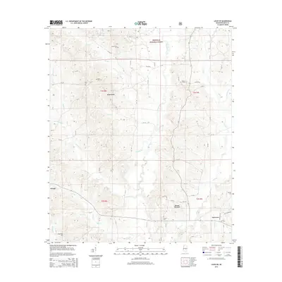
2015 Map of Louin SW
USGS Topo · Published 2015About this map
Bienville National Forest dominates the northern and eastern portions of this landscape, where the Leaf River and its numerous tributaries like Pete Br and Shongelo Cr carve through the Mississippi terrain. The town of Raleigh is situated in the west, while Sylvarena sits in the southeast, connected by a network of rural routes such as Old 18 Dr and Ted Sylvarena Rd. This 2015 survey illustrates a rural community anchored by its historic burial grounds, including Sylvan Grove Cem and Mount Nebo Cem, which are often located near small settlements like Sand Point and Mount Pleasant. The intricate drainage patterns of Ichusa Cr and Nelse Br define the local topography, revealing the persistence of traditional land divisions and forest boundaries in Smith County.
Find a feature on this map
53 named features on this map. Tap any name to fly to it.
Don’t see what you’re looking for? This feature index may not catch every label — zoom into the map to look around manually.
Map Details
Editions of this 2015 Louin SW Map
This is the sole edition of this map. No revisions or reprints were ever made.
Other maps of this area

1953 · Hattiesburg
USGS Topo · 1:250,000

1953 · Meridian
USGS Topo · 1:250,000

1957 · Meridian
USGS Topo · 1:250,000

1958 · Hattiesburg
USGS Topo · 1:250,000

1965 · Meridian
USGS Topo · 1:250,000

1968 · Clear Springs
USGS Topo · 1:24,000

1968 · Pineville
USGS Topo · 1:24,000
1968 · Homewood
USGS Topo · 1:24,000

1968 · Raleigh
USGS Topo · 1:24,000

1968 · Louin
USGS Topo · 1:24,000