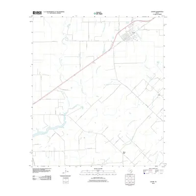
2010 Map of Louise
USGS Topo · Published 2010About this map
Louise stands as the primary hub in this coastal prairie landscape, its grid of streets anchored by State Spur 523 and Plainview Rd. The surrounding terrain is defined by an intricate network of drainage, where West Mustang Creek, Middle Mustang Creek, and East Mustang Creek converge as they flow south toward the Gulf. To the southeast, the small settlement of White Hall and the Louise Oil Field point to the region's agricultural and energy-based economy. This detailed study of the area's hydrology also reveals numerous smaller tributaries such as McFarland Creek and Stage Stand Creek. Long-standing family-named routes like J D Herins Ranch Rd and Jungnickel Rd illustrate the rural land divisions and ranching heritage of Jackson County in the early 21st century.
Find a feature on this map
46 named features on this map. Tap any name to fly to it.
Don’t see what you’re looking for? This feature index may not catch every label — zoom into the map to look around manually.
Map Details
Editions of this 2010 Louise Map
This is the sole edition of this map. No revisions or reprints were ever made.
Other maps of this area

1952 · Francitas NW
USGS Topo · 1:24,000

1952 · Manson
USGS Topo · 1:24,000

1952 · Francitas NE
USGS Topo · 1:24,000

1953 · Beeville
USGS Topo · 1:250,000

1953 · Seguin
USGS Topo · 1:250,000

1956 · Beeville
USGS Topo · 1:250,000

1958 · Seguin
USGS Topo · 1:250,000

1960 · Beeville
USGS Topo · 1:250,000

1963 · Ganado
USGS Topo · 1:24,000

1965 · El Campo
USGS Topo · 1:24,000