
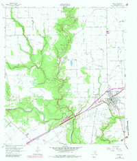
1963 Map of Ganado
USGS Topo · Published 1965About this map
Navidad River and its meandering tributaries define this Jackson County landscape, where the town of Ganado sits at the intersection of rail and river commerce. The Southern Pacific railroad cuts a straight line through the territory, passing just south of the town's residential center and the local Ganado Airport. This era shows a region deeply involved in the petroleum industry, with extensive operations at the Cordele Oil Field, Sandy Creek Oil Field, and Ganado West Oil Field. Rural life is marked by a network of family-named roads such as Matus Road and Kuhlman Road, leading to community landmarks like the Assumption Cemetery and Ganado Cem. The presence of these cemeteries and the small municipal Jaycee Park provide clear points of reference for genealogists and local historians tracing the development of this coastal prairie community.
Find a feature on this map
30 named features on this map. Tap any name to fly to it.
Don’t see what you’re looking for? This feature index may not catch every label — zoom into the map to look around manually.
Map Details
Editions of this 1963 Ganado Map
2 editions found
Other maps of this area

1952 · Francitas NW
USGS Topo · 1:24,000

1952 · Manson
USGS Topo · 1:24,000

1952 · Edna
USGS Topo · 1:24,000

1953 · Beeville
USGS Topo · 1:250,000

1953 · Seguin
USGS Topo · 1:250,000

1956 · Beeville
USGS Topo · 1:250,000

1958 · Seguin
USGS Topo · 1:250,000

1960 · Beeville
USGS Topo · 1:250,000

1963 · Mount Olive
USGS Topo · 1:24,000

1964 · Cordele
USGS Topo · 1:24,000