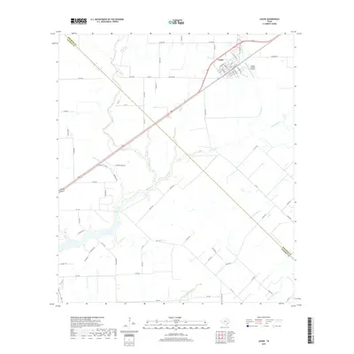
2019 Map of Louise
USGS Topo · Published 2019About this map
Louise serves as the primary center of activity in this part of the Coastal Plain, showing a grid of streets including Main St and Colorado St that facilitate local movement. The landscape is defined by an intricate drainage system, where waterways such as W Mustang Cr and Middle Mustang Cr converge and flow toward the Gulf. These creeks, including McFarland Cr and Stage Stand Cr, suggest a land primarily shaped by its hydrological patterns and agricultural utility. The Wharton Co Jackson Co line cuts diagonally across the survey, highlighting the administrative divide in this rural corridor. Near the town, the Flying V Ranch Airport provides a point of aerial access, while a dense network of county roads like Co Rd 382 and Co Rd 265 connects the scattered homesteads and ranch lands.
Find a feature on this map
75 named features on this map. Tap any name to fly to it.
Don’t see what you’re looking for? This feature index may not catch every label — zoom into the map to look around manually.
Map Details
Editions of this 2019 Louise Map
This is the sole edition of this map. No revisions or reprints were ever made.
Other maps of this area

1952 · Francitas NW
USGS Topo · 1:24,000

1952 · Manson
USGS Topo · 1:24,000

1952 · Francitas NE
USGS Topo · 1:24,000

1953 · Beeville
USGS Topo · 1:250,000

1953 · Seguin
USGS Topo · 1:250,000

1956 · Beeville
USGS Topo · 1:250,000

1958 · Seguin
USGS Topo · 1:250,000

1960 · Beeville
USGS Topo · 1:250,000

1963 · Ganado
USGS Topo · 1:24,000

1965 · El Campo
USGS Topo · 1:24,000