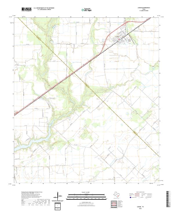
2022 Map of Louise
USGS Topo · Published 2022About this map
The town of Louise serves as the primary hub for this agricultural and ranching landscape on the Coastal Plain, centered around the intersection of Fm 1160 Rd and several local streets such as Wharton St and Colorado St. The settlement is closely tied to the railway corridor that cuts diagonally across the terrain, shaping the local grid and connecting the community to the wider region. Just to the east, the Flying V Ranch Airport provides a localized aviation link for the surrounding rural estates.
Find a feature on this map
74 named features on this map. Tap any name to fly to it.
Don’t see what you’re looking for? This feature index may not catch every label — zoom into the map to look around manually.
Map Details
Editions of this 2022 Louise Map
This is the sole edition of this map. No revisions or reprints were ever made.
Other maps of this area

1952 · Francitas NW
USGS Topo · 1:24,000

1952 · Manson
USGS Topo · 1:24,000

1952 · Francitas NE
USGS Topo · 1:24,000

1953 · Beeville
USGS Topo · 1:250,000

1953 · Seguin
USGS Topo · 1:250,000

1956 · Beeville
USGS Topo · 1:250,000

1958 · Seguin
USGS Topo · 1:250,000

1960 · Beeville
USGS Topo · 1:250,000

1963 · Ganado
USGS Topo · 1:24,000

1965 · El Campo
USGS Topo · 1:24,000