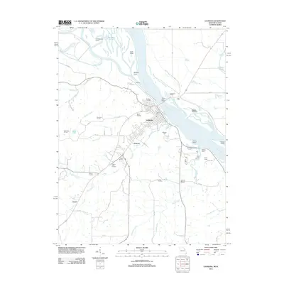
2012 Map of Louisiana
USGS Topo · Published 2012About this map
Louisiana serves as a critical river crossing where the Champ Clark Bridge spans the Mississippi River, connecting Missouri to Illinois. The landscape is defined by the convergence of several major water systems, including the Salt River, Noix Creek, and Grassy Creek. Significant island formations such as Angle Island and Blackburn Island break the river's flow near the historic town center. The area shows a high concentration of local heritage sites, with several burial grounds including Riverview Cemetery overlooking the water and the Gates of Peace Cemetery situated near the commercial operations of Stark Nursery. To the west and south, the terrain transitions into a network of small drainages like Tanyard Branch and Little Buffalo Creek, while smaller aviation hubs such as Hoover Field and the Mark Twain Air Park serve the regional community.
Find a feature on this map
51 named features on this map. Tap any name to fly to it.
Don’t see what you’re looking for? This feature index may not catch every label — zoom into the map to look around manually.
Map Details
Editions of this 2012 Louisiana Map
This is the sole edition of this map. No revisions or reprints were ever made.
Other maps of this area

1890 · Louisiana
USGS Topo · 1:125,000

1926 · Pittsfield
USGS Topo · 1:62,500

1930 · Nebo
USGS Topo · 1:62,500

1931 · Barry
USGS Topo · 1:62,500

1934 · Nebo
USGS Topo · 1:48,000

1936 · Barry
USGS Topo · 1:48,000

1937 · Bowling Green
USGS Topo · 1:62,500

1940 · Bowling Green
USGS Topo · 1:62,500

1942 · Nebo
USGS Topo · 1:62,500

1944 · Barry
USGS Topo · 1:62,500