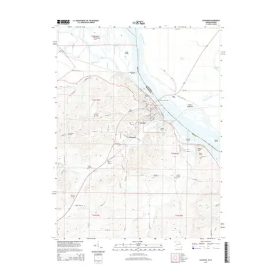
2015 Map of Louisiana
USGS Topo · Published 2015About this map
The Mississippi River defines the eastern boundary of this Missouri landscape, where the city of Louisiana sits as a primary riverfront hub. The terrain moves from the low-lying alluvial plains of Plum Point Slough and Sand Slough to the prominent heights of Clinton Hill and Buffalo Knob. For genealogists, the map is particularly rich in burial sites, documenting Riverview Cemetery overlooking the water, as well as the Gates of Peace Cemetery, Bethany Cemetery, and Noix Creek Cemetery. Transportation patterns are anchored by the river crossing at the Champ Clark Bridge and the small aviation facility at Mark Twain Air Park. The map also captures several distinct river islands, such as Angle Island and Blackburn Island, which sit near the confluence with the Salt River.
Find a feature on this map
91 named features on this map. Tap any name to fly to it.
Don’t see what you’re looking for? This feature index may not catch every label — zoom into the map to look around manually.
Map Details
Editions of this 2015 Louisiana Map
This is the sole edition of this map. No revisions or reprints were ever made.
Other maps of this area

1890 · Louisiana
USGS Topo · 1:125,000

1926 · Pittsfield
USGS Topo · 1:62,500

1930 · Nebo
USGS Topo · 1:62,500

1931 · Barry
USGS Topo · 1:62,500

1934 · Nebo
USGS Topo · 1:48,000

1936 · Barry
USGS Topo · 1:48,000

1937 · Bowling Green
USGS Topo · 1:62,500

1940 · Bowling Green
USGS Topo · 1:62,500

1942 · Nebo
USGS Topo · 1:62,500

1944 · Barry
USGS Topo · 1:62,500