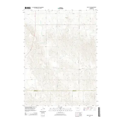
2014 Map of Loup City NW
USGS Topo · Published 2014About this map
Sherman and Valley counties meet along a surveyed line in this portion of central Nebraska, where the landscape is defined by the dendritic drainage patterns of the Loup River system. The northern reaches of Oak Cr and the headwaters of Davis Cr carve through the terrain, while the north and south branches of Mira Creek—labeled as N Br Mira Cr and S Br Mira Cr—meander toward the east. These watercourses influenced the placement of early rural landmarks like the Evangelical Cem and the Davis Creek Cem, which remain as essential points of reference for local family history. The rigid grid of section roads, including 805th RD and 797th RD, is interrupted only by the diagonal path of Ne-70, illustrating the persistent tension between the geometric Homestead Act land divisions and the natural topography of the Plains.
Find a feature on this map
18 named features on this map. Tap any name to fly to it.
Don’t see what you’re looking for? This feature index may not catch every label — zoom into the map to look around manually.
Map Details
Editions of this 2014 Loup City NW Map
This is the sole edition of this map. No revisions or reprints were ever made.
Other maps of this area

1899 · Loup
USGS Topo · 1:125,000

1951 · Arcadia SE
USGS Topo · 1:24,000

1951 · Arcadia East
USGS Topo · 1:24,000

1952 · Comstock SE
USGS Topo · 1:24,000

1953 · Loup City NW
USGS Topo · 1:24,000

1953 · North Loup
USGS Topo · 1:24,000

1953 · Loup City SE
USGS Topo · 1:24,000

1953 · Loup City
USGS Topo · 1:24,000

1954 · Ord SE
USGS Topo · 1:24,000

1954 · Ord
USGS Topo · 1:24,000