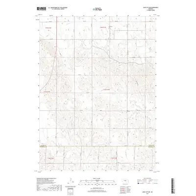
2017 Map of Loup City NW
USGS Topo · Published 2017About this map
Davis Creek Cem and the Evangelical Cem are notable historical markers in this rural landscape straddling the border between Valley Co and Sherman Co. The terrain is defined by a dense network of seasonal drainages, including the headwaters of Oak Creek and Davis Creek, as well as the north and south branches of Mira Creek. The township and range lines of t17n r14w and t18n r14w organize a grid of rural roads like 800 RD and 805th Rd. This pattern reflects the enduring agricultural footprint of central Nebraska, where the land is divided into sections that dictate the placement of farmsteads and transport routes through the dissected plains.
Find a feature on this map
27 named features on this map. Tap any name to fly to it.
Don’t see what you’re looking for? This feature index may not catch every label — zoom into the map to look around manually.
Map Details
Editions of this 2017 Loup City NW Map
This is the sole edition of this map. No revisions or reprints were ever made.
Other maps of this area

1899 · Loup
USGS Topo · 1:125,000

1951 · Arcadia SE
USGS Topo · 1:24,000

1951 · Arcadia East
USGS Topo · 1:24,000

1952 · Comstock SE
USGS Topo · 1:24,000

1953 · Loup City NW
USGS Topo · 1:24,000

1953 · North Loup
USGS Topo · 1:24,000

1953 · Loup City SE
USGS Topo · 1:24,000

1953 · Loup City
USGS Topo · 1:24,000

1954 · Ord SE
USGS Topo · 1:24,000

1954 · Ord
USGS Topo · 1:24,000