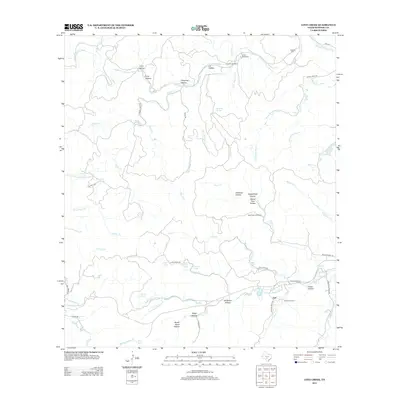
2012 Map of Love Creek
USGS Topo · Published 2012About this map
The settlement of Tuff and its surrounding ranch lands define this portion of the Texas Hill Country, where the various prongs of the Medina River carve through a landscape of named hollows and creek beds. This 2012 survey documents the persistent rural character of Bandera County, centered around the N Prong Medina River and W Prong Medina River. Local family history is preserved at the Adams Cemetery, Hillman Cem, and Honey Creek Cem, while working landscapes like Honey Creek Ranch and Rock Chimney Ranch illustrate the area's continued agricultural heritage. The terrain is intricately detailed with specific landmarks such as Raven Roost Hollow, Copperhead Hollow, and Board Tree Hollow, showing how the early inhabitants named every draw and spring. Modern road networks like Ranch Road 337 and the Allsup Trl provide access through the deep drainages of Love Cr and Elam Cr.
Find a feature on this map
69 named features on this map. Tap any name to fly to it.
Don’t see what you’re looking for? This feature index may not catch every label — zoom into the map to look around manually.
Map Details
Editions of this 2012 Love Creek Map
This is the sole edition of this map. No revisions or reprints were ever made.
Other maps of this area

1954 · San Antonio
USGS Topo · 1:250,000

1956 · Tarpley
USGS Topo · 1:62,500

1956 · Tuff
USGS Topo · 1:62,500

1956 · Utopia
USGS Topo · 1:62,500

1957 · San Antonio
USGS Topo · 1:250,000

1964 · Sabinal Canyon
USGS Topo · 1:24,000

1964 · Well Hollow
USGS Topo · 1:24,000

1964 · Diamond S Ranch
USGS Topo · 1:24,000

1964 · Echo Hill Ranch
USGS Topo · 1:24,000
1964 · Love Creek
USGS Topo · 1:24,000