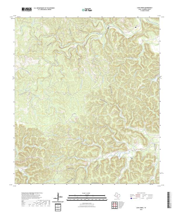
2022 Map of Love Creek
USGS Topo · Published 2022About this map
The N Prong Medina River headwaters and its numerous tributary creeks define this portion of Bandera County. The landscape is deeply incised by a network of drainage features like Copperhead Hollow, Slaughter Hollow, and Freedom Hollow, reflecting the complex hydrology of the Texas Hill Country. Settlements are sparse, represented primarily by family-named ranch roads and secluded cemeteries such as Hillman Cem and Honey Creek Cem, which offer significant value for genealogists tracing local lineage in this rural corridor.
Find a feature on this map
70 named features on this map. Tap any name to fly to it.
Don’t see what you’re looking for? This feature index may not catch every label — zoom into the map to look around manually.
Map Details
Editions of this 2022 Love Creek Map
This is the sole edition of this map. No revisions or reprints were ever made.
Other maps of this area

1954 · San Antonio
USGS Topo · 1:250,000

1956 · Tarpley
USGS Topo · 1:62,500

1956 · Tuff
USGS Topo · 1:62,500

1956 · Utopia
USGS Topo · 1:62,500

1957 · San Antonio
USGS Topo · 1:250,000

1964 · Sabinal Canyon
USGS Topo · 1:24,000

1964 · Well Hollow
USGS Topo · 1:24,000

1964 · Diamond S Ranch
USGS Topo · 1:24,000

1964 · Echo Hill Ranch
USGS Topo · 1:24,000
1964 · Love Creek
USGS Topo · 1:24,000