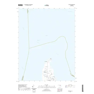
2019 Map of Love Point
USGS Topo · Published 2019About this map
Love Point marks the northernmost tip of Kent Island, standing as a geographic anchor where the Chester River meets the Chesapeake Channel. This coastal survey highlights the maritime importance of the area, featuring the Intracoastal Waterway and the junction of several major Maryland river systems, including the Potapsco River and Magothy River. The land use at the northern end of the island is predominantly residential, characterized by the modern street grids of Cloverfields and surrounding neighborhoods.
Find a feature on this map
31 named features on this map. Tap any name to fly to it.
Don’t see what you’re looking for? This feature index may not catch every label — zoom into the map to look around manually.
Map Details
Editions of this 2019 Love Point Map
This is the sole edition of this map. No revisions or reprints were ever made.
Other maps of this area

1892 · Annapolis
USGS Topo · 1:62,500

1893 · North Point
USGS Topo · 1:62,500

1898 · Choptank
USGS Topo · 1:125,000

1898 · Tolchester
USGS Topo · 1:125,000

1901 · Chestertown
USGS Topo · 1:62,500

1903 · Tolchester
USGS Topo · 1:125,000

1904 · St. Michaels
USGS Topo · 1:62,500

1904 · North Point
USGS Topo · 1:62,500

1904 · Annapolis
USGS Topo · 1:62,500

1908 · Tolchester
USGS Topo · 1:125,000