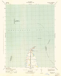
1942 Map of Love Point
USGS Topo · Published 1942About this map
The northern tip of Kent Island stands as a vital maritime and rail hub during the early 1940s, where the Baltimore and Eastern railroad terminates at the water's edge. This land-sea interface is defined by the Love Point-Baltimore Ferry route, which provided a critical link across the Chesapeake Bay. The map reveals a landscape shaped by coastal navigation, anchored by the Love Point Lighthouse and the Love Point Tower No 16 overlooking the mouth of the Chester River.
Find a feature on this map
20 named features on this map. Tap any name to fly to it.
Don’t see what you’re looking for? This feature index may not catch every label — zoom into the map to look around manually.
Map Details
Editions of this 1942 Love Point Map
This is the sole edition of this map. No revisions or reprints were ever made.
Other maps of this area

1892 · Annapolis
USGS Topo · 1:62,500

1893 · North Point
USGS Topo · 1:62,500

1898 · Choptank
USGS Topo · 1:125,000

1898 · Tolchester
USGS Topo · 1:125,000

1901 · Chestertown
USGS Topo · 1:62,500

1903 · Tolchester
USGS Topo · 1:125,000

1904 · St. Michaels
USGS Topo · 1:62,500

1904 · North Point
USGS Topo · 1:62,500

1904 · Annapolis
USGS Topo · 1:62,500

1908 · Tolchester
USGS Topo · 1:125,000