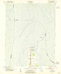
1953 Map of Love Point
USGS Topo · Published 1955About this map
Kent Island anchors this mid-century maritime study, showcasing the northernmost tip where the Chesapeake Bay meets the Chester River. The landscape is dominated by the strategic terminal of the Baltimore and Eastern railroad, which reaches into the water at Love Point. This nexus of rail and river commerce is punctuated by the Love Point Lighthouse, a critical navigational aid for vessels transitioning between the bay and the river mouth. The map captures a moment when the shoreline around Camp St Martin and the local landing areas were vital hubs for Eastern Shore transportation. The offshore soundings and detailed hydrography provide a clear picture of the shifting shoals and deep-water channels that defined the nautical life of the region during the early 1950s.
Find a feature on this map
11 named features on this map. Tap any name to fly to it.
Don’t see what you’re looking for? This feature index may not catch every label — zoom into the map to look around manually.
Map Details
Editions of this 1953 Love Point Map
2 editions found
Other maps of this area

1892 · Annapolis
USGS Topo · 1:62,500

1893 · North Point
USGS Topo · 1:62,500

1898 · Choptank
USGS Topo · 1:125,000

1898 · Tolchester
USGS Topo · 1:125,000

1901 · Chestertown
USGS Topo · 1:62,500

1903 · Tolchester
USGS Topo · 1:125,000

1904 · St. Michaels
USGS Topo · 1:62,500

1904 · North Point
USGS Topo · 1:62,500

1904 · Annapolis
USGS Topo · 1:62,500

1908 · Tolchester
USGS Topo · 1:125,000