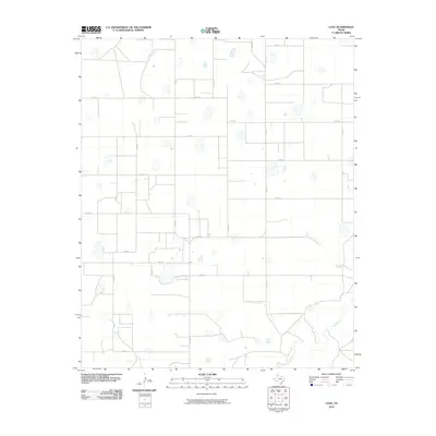
2010 Map of Love
USGS Topo · Published 2010About this map
Love serves as the central settlement point in this section of the Texas Panhandle, positioned at the intersection of FM 2301 and FM 1318. The landscape is defined by a rigid grid of agricultural roads, including Co RD K and Co RD N, which partition the high plains into large, productive tracts. This geometric order is broken only in the southern reaches by the winding course of Tule Creek, where the terrain begins to drop away from the flat upland plateau. The map documents a sparsely populated but highly organized rural landscape where transportation is dominated by Farm to Market roads like FM 3300, essential for moving goods through the county. The numerous depressions scattered across the plains suggest a land shaped by playa lakes, characteristic of the Llano Estacado's unique hydrology.
Find a feature on this map
21 named features on this map. Tap any name to fly to it.
Don’t see what you’re looking for? This feature index may not catch every label — zoom into the map to look around manually.
Map Details
Editions of this 2010 Love Map
This is the sole edition of this map. No revisions or reprints were ever made.
Other maps of this area

1954 · Plainview
USGS Topo · 1:250,000

1958 · Plainview
USGS Topo · 1:250,000

1965 · Rock Creek
USGS Topo · 1:24,000

1965 · Vigo Park
USGS Topo · 1:24,000

1965 · Cope Creek
USGS Topo · 1:24,000

1968 · Tule Lake
USGS Topo · 1:24,000

1969 · Love
USGS Topo · 1:24,000

1969 · Jackson Hill
USGS Topo · 1:24,000

1969 · Claytonville
USGS Topo · 1:24,000

1969 · Tule Lake NW
USGS Topo · 1:24,000