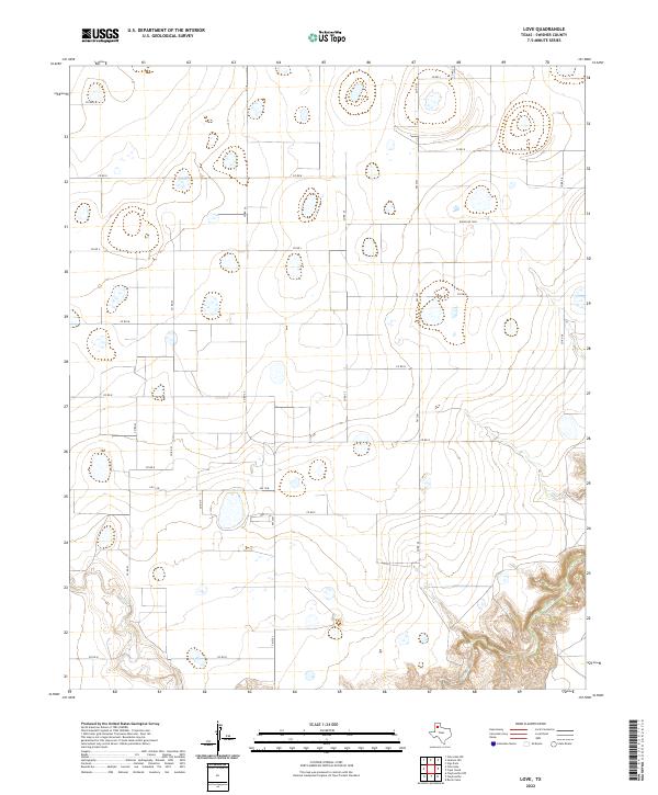
2022 Map of Love
USGS Topo · Published 2022About this map
Tule Cr carves deep, dramatic canyons through the southern portions of this Swisher County landscape, providing a stark contrast to the vast, high plains above. The terrain is defined by numerous playa lakes and depressions scattered across the surface, reflecting the unique hydrology of the Texas Panhandle. This area is heavily segmented by a rigid grid of agricultural roads, including Fm 2301 and Fm 1318, which facilitate the movement of livestock and crops between local ranching outposts. The map reveals the intersection of modern ranching infrastructure, such as Ranch Rd 3300, with the natural erosional features of the canyonlands, illustrating how land use is dictated by the sharp descent from the caprock into the drainage basins below.
Find a feature on this map
20 named features on this map. Tap any name to fly to it.
Don’t see what you’re looking for? This feature index may not catch every label — zoom into the map to look around manually.
Map Details
Editions of this 2022 Love Map
This is the sole edition of this map. No revisions or reprints were ever made.
Other maps of this area

1954 · Plainview
USGS Topo · 1:250,000

1958 · Plainview
USGS Topo · 1:250,000

1965 · Rock Creek
USGS Topo · 1:24,000

1965 · Vigo Park
USGS Topo · 1:24,000

1965 · Cope Creek
USGS Topo · 1:24,000

1968 · Tule Lake
USGS Topo · 1:24,000

1969 · Love
USGS Topo · 1:24,000

1969 · Jackson Hill
USGS Topo · 1:24,000

1969 · Claytonville
USGS Topo · 1:24,000

1969 · Tule Lake NW
USGS Topo · 1:24,000