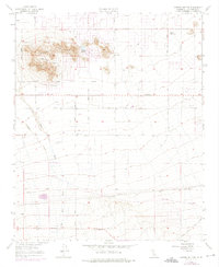
1957 Map of Lovejoy Buttes
USGS Topo · Published 1975About this map
Lovejoy Buttes dominates the northern landscape of this Mojave Desert region, rising above a grid of surveyed avenues and early infrastructure. The map documents a period of desert development where isolated homesteads and outposts like Wilsona Ranch and the small settlement of Wilsona established a presence near the natural reliable water of Lovejoy Springs. To the south, the transportation corridor is more defined, anchored by the Southern Pacific railroad line and the Pearblossom Highway.
Find a feature on this map
21 named features on this map. Tap any name to fly to it.
Don’t see what you’re looking for? This feature index may not catch every label — zoom into the map to look around manually.
Map Details
Editions of this 1957 Lovejoy Buttes Map
4 editions found
Other maps of this area

1901 · Southern California Sheet No. 1
USGS Topo · 1:250,000

1903 · Rock Creek
USGS Topo · 1:62,500

1903 · San Antonio
USGS Topo · 1:62,500

1904 · Southern California Sheet No. 1
USGS Topo · 1:250,000

1930 · Lovejoy Springs
USGS Topo · 1:24,000

1930 · Black Butte
USGS Topo · 1:24,000

1930 · Llano
USGS Topo · 1:24,000

1930 · Wilsona
USGS Topo · 1:24,000

1933 · Lovejoy Springs
USGS Topo · 1:24,000

1933 · Black Butte
USGS Topo · 1:24,000