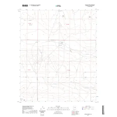
2023 Map of Lovelady Draw
USGS Topo · Published 2023About this map
Lovelady Draw and its complex network of seasonal drainages define this stretch of De Baca County. This interior landscape is marked by name-bearing topographical features such as Whites Draw, Gillespie Draw, and Wylie Draw, which channel water toward intermittent basins like Arroyo Mora and Arroyo Arana. The Presence of Lovelady Spring suggests a vital reliable water source in this arid environment, a fact reinforced by the strategic placement of Galloway Tank and Short Tank. The human footprint is sparse but functional, centered on the Double V Ranch Airport and a grid of ranch roads including Cowchip Rd and Horseshoe Rd. These local names reflect a working cattle-ranching heritage that persists into the 2020s, with large-scale land divisions remaining the primary organizational structure of the region.
Find a feature on this map
24 named features on this map. Tap any name to fly to it.
Don’t see what you’re looking for? This feature index may not catch every label — zoom into the map to look around manually.
Map Details
Editions of this 2023 Lovelady Draw Map
This is the sole edition of this map. No revisions or reprints were ever made.
Other maps of this area

1954 · Fort Sumner
USGS Topo · 1:250,000

1955 · Roswell
USGS Topo · 1:250,000

1958 · Fort Sumner
USGS Topo · 1:250,000

1958 · Roswell
USGS Topo · 1:250,000

1962 · Roswell
USGS Topo · 1:250,000

1967 · Deering Place
USGS Topo · 1:24,000

1967 · Dunlap NE
USGS Topo · 1:24,000

1967 · Dunlap Sill
USGS Topo · 1:24,000

1967 · Conejo Creek West
USGS Topo · 1:24,000

1967 · Swallow Nest Canyon
USGS Topo · 1:24,000