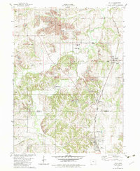
1982 Map of Lovilia
USGS Topo · Published 1983About this map
Extensive Strip Mines dominate the landscape of the Marion and Monroe county line in this early 1980s survey. These excavations follow the winding course of Cedar Creek and its tributaries, including Honey Creek and North Cedar Creek, creating a complex industrial pattern that encircles the established settlements of Bussey, Hamilton, and Marysville. The map provides a detailed view of the regional infrastructure before significant reclamation efforts, showing the proximity of active mining areas to residential centers and the Norfolk and Western railroad corridor.
Find a feature on this map
31 named features on this map. Tap any name to fly to it.
Don’t see what you’re looking for? This feature index may not catch every label — zoom into the map to look around manually.
Map Details
Editions of this 1982 Lovilia Map
This is the sole edition of this map. No revisions or reprints were ever made.
Other maps of this area

1909 · Knoxville
USGS Topo · 1:62,500

1910 · Pella
USGS Topo · 1:62,500

1912 · Knoxville
USGS Topo · 1:62,500

1912 · Pella
USGS Topo · 1:62,500

1924 · Melcher
USGS Topo · 1:62,500

1929 · Albia
USGS Topo · 1:62,500

1954 · Des Moines
USGS Topo · 1:250,000

1956 · Des Moines
USGS Topo · 1:250,000

1957 · Des Moines
USGS Topo · 1:250,000
1965 · Knoxville
USGS Topo · 1:24,000