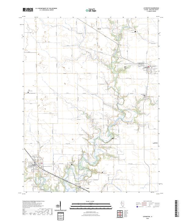
2024 Map of Lovington
USGS Topo · Published 2024About this map
The West Okaw River meanders through the heart of this Moultrie County landscape, carving a wooded corridor through the surrounding agricultural grid. This 2024 survey documents the village of Lovington in the northeast and the community of Bethany in the southwest, connected by a network of rural routes like Co HWY 1 and Old Springfield. The area is characterized by its density of small family and township burial grounds, providing a significant resource for genealogical research. Notable sites include the Marrowbone Township Cem near Bethany and the Saint Isadore Cem to the north. Smaller hamlets and junctions such as Ullrich, Cushman, and Dunn anchor the corners of the quadrangle, while smaller waterways like Jonathan Branch and Stringtown Branch feed into the primary river system, shaping the local drainage and topography.
Find a feature on this map
82 named features on this map. Tap any name to fly to it.
Don’t see what you’re looking for? This feature index may not catch every label — zoom into the map to look around manually.
Map Details
Editions of this 2024 Lovington Map
This is the sole edition of this map. No revisions or reprints were ever made.
Other maps of this area

1929 · Decatur
USGS Topo · 1:62,500

1933 · Decatur
USGS Topo · 1:62,500

1935 · Sullivan
USGS Topo · 1:48,000

1940 · Sullivan
USGS Topo · 1:62,500

1949 · Dalton City
USGS Topo · 1:62,500

1955 · Bement
USGS Topo · 1:62,500

1958 · Decatur
USGS Topo · 1:250,000

1961 · Decatur
USGS Topo · 1:250,000

1967 · Long Creek
USGS Topo · 1:24,000
1975 · Bement SE
USGS Topo · 1:24,000