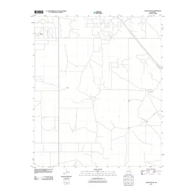
2010 Map of Lovington SE
USGS Topo · Published 2010About this map
The West Lovington Oil Field defines the industrial character of this southeastern New Mexico landscape, where the energy economy of Lea County meets traditional ranching roots. Extensive networks of section-line roads like County Rd-78 and County Rd-81 provide access to the flat terrain, connecting isolated ranching outposts such as Turner Ranch, Kimborough Ranch, and Culp Ranch. These family-named landmarks, paired with vital water sources like Adobe Well and Eller Well, illustrate the essential infrastructure required for survival and industry in the High Plains. The transition from local thoroughfares to regional transit is marked by the presence of the N Lovington Hwy, which skirts the eastern edge of the survey area, linking the rural oil and cattle country to the larger municipality of Lovington.
Find a feature on this map
13 named features on this map. Tap any name to fly to it.
Don’t see what you’re looking for? This feature index may not catch every label — zoom into the map to look around manually.
Map Details
Editions of this 2010 Lovington SE Map
This is the sole edition of this map. No revisions or reprints were ever made.
Other maps of this area

1954 · Hobbs
USGS Topo · 1:250,000

1958 · Hobbs
USGS Topo · 1:250,000

1962 · Lovington
USGS Topo · 1:24,000

1962 · Lovington
USGS Topo · 1:62,500

1963 · Monument
USGS Topo · 1:62,500

1969 · Humble City
USGS Topo · 1:24,000

1969 · Hobbs West
USGS Topo · 1:24,000
1985 · Monument North
USGS Topo · 1:24,000
1985 · Lovington NW
USGS Topo · 1:24,000
1985 · Lovington SE
USGS Topo · 1:24,000