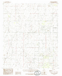
1985 Map of Lovington NW
USGS Topo · Published 1985About this map
Oil Field operations dominate the landscape of this corner of Lea County in the mid-1980s, reflecting the intense industrial character of the Llano Estacado. The presence of the Eidson Oil Field and numerous unnamed drilling pads throughout the terrain indicates the scale of the region's petroleum economy during this era. Infrastructure for air travel is centered at the Municipal Airport in the eastern portion of the map, while a lone Road Side Park suggests the sparse rest stops along the highway network. This 1:24,000 scale study, based on 1970s aerial photography and 1979 field checks, serves as a precise record of the energy industry's footprint and the specialized transportation needs of the New Mexico plains.
Find a feature on this map
4 named features on this map. Tap any name to fly to it.
Don’t see what you’re looking for? This feature index may not catch every label — zoom into the map to look around manually.
Map Details
Editions of this 1985 Lovington NW Map
This is the sole edition of this map. No revisions or reprints were ever made.
Other maps of this area

1954 · Hobbs
USGS Topo · 1:250,000

1954 · Brownfield
USGS Topo · 1:250,000

1958 · Brownfield
USGS Topo · 1:250,000

1958 · Hobbs
USGS Topo · 1:250,000

1962 · Brownfield
USGS Topo · 1:250,000

1962 · Lovington
USGS Topo · 1:24,000

1962 · Lovington
USGS Topo · 1:62,500

1962 · Buckeye
USGS Topo · 1:62,500

1970 · Hillburn City
USGS Topo · 1:24,000

1970 · Hillburn City SW
USGS Topo · 1:24,000