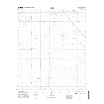
2017 Map of Lovington SE
USGS Topo · Published 2017About this map
Arkansas Junction serves as the primary north-south corridor through this high plains landscape in Lea County, anchoring a network of rural roads that define the region's geometric layout. The area is characterized by large township and range blocks, including t17s r36e and t17s r37e, which reflect the systematic organization of New Mexico's ranching and industrial lands.
Find a feature on this map
14 named features on this map. Tap any name to fly to it.
Don’t see what you’re looking for? This feature index may not catch every label — zoom into the map to look around manually.
Map Details
Editions of this 2017 Lovington SE Map
This is the sole edition of this map. No revisions or reprints were ever made.
Other maps of this area

1954 · Hobbs
USGS Topo · 1:250,000

1958 · Hobbs
USGS Topo · 1:250,000

1962 · Lovington
USGS Topo · 1:24,000

1962 · Lovington
USGS Topo · 1:62,500

1963 · Monument
USGS Topo · 1:62,500

1969 · Humble City
USGS Topo · 1:24,000

1969 · Hobbs West
USGS Topo · 1:24,000
1985 · Monument North
USGS Topo · 1:24,000
1985 · Lovington NW
USGS Topo · 1:24,000
1985 · Lovington SE
USGS Topo · 1:24,000