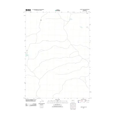
2011 Map of Lowe Valley
USGS Topo · Published 2011About this map
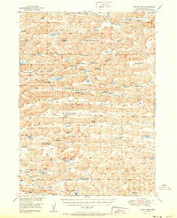
Lowe Valley characterizes this high plains landscape in Cherry County, defined by its sparse settlement and the rolling contours of the Nebraska Sandhills. At the time of this 2011 survey, the area remains primarily dedicated to ranching, with the Andrick Ranch located near the western edge of the sheet. Water is a defining feature of the local topography, represented by the isolated Granning Lake and several smaller unnamed ponds scattered across the terrain. To the northeast, Becker Field provides a specific point of reference in an otherwise open expanse of grazing land. The map illustrates a network of secondary roads and trails that connect these remote ranching outposts, reflecting the enduring rural character of this portion of northern Nebraska.
Find a feature on this map
4 named features on this map. Tap any name to fly to it.
Don’t see what you’re looking for? This feature index may not catch every label — zoom into the map to look around manually.
Map Details
Editions of this 2011 Lowe Valley Map
This is the sole edition of this map. No revisions or reprints were ever made.
Other maps of this area
1948 · Ashby
USGS Topo · 1:62,500
1948 · Bingham
USGS Topo · 1:62,500
1948 · Spade Ranch
USGS Topo · 1:62,500
1949 · Ashby
USGS Topo · 1:62,500
1949 · Turpin Lake
USGS Topo · 1:62,500
1950 · Spade Ranch
USGS Topo · 1:62,500
1950 · Bingham
USGS Topo · 1:62,500
1951 · Turpin Lake
USGS Topo · 1:62,500

1955 · Alliance
USGS Topo · 1:250,000

1957 · Alliance
USGS Topo · 1:250,000