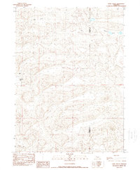
1989 Map of Lowe Valley
USGS Topo · Published 1989About this map
Lowe Valley and Hospital Valley define the undulating sandhill landscape of this 1980s topographic survey along the Nebraska border. The map documents a sparsely settled ranching territory where the Sheridan Co and Cherry Co line cuts through the drainages. Permanent water features like Granning Lake serve as vital landmarks in a terrain characterized by complex contour patterns and isolated outposts. Notable human activity is centered on the Andrick Ranch and Becker Field, showing the infrastructure required to manage these remote northern Nebraska range lands during the late twentieth century.
Find a feature on this map
8 named features on this map. Tap any name to fly to it.
Don’t see what you’re looking for? This feature index may not catch every label — zoom into the map to look around manually.
Map Details
Editions of this 1989 Lowe Valley Map
This is the sole edition of this map. No revisions or reprints were ever made.
Other maps of this area

1948 · Ashby
USGS Topo · 1:62,500

1948 · Bingham
USGS Topo · 1:62,500

1948 · Spade Ranch
USGS Topo · 1:62,500

1949 · Ashby
USGS Topo · 1:62,500

1949 · Turpin Lake
USGS Topo · 1:62,500

1950 · Spade Ranch
USGS Topo · 1:62,500

1950 · Bingham
USGS Topo · 1:62,500

1951 · Turpin Lake
USGS Topo · 1:62,500

1955 · Alliance
USGS Topo · 1:250,000

1957 · Alliance
USGS Topo · 1:250,000