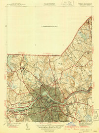
1941 Map of Lowell
USGS Topo · Published 1941About this map
The Merrimack River powers the industrial heart of this region, flowing past the dense urban grids of Centraville, Belvidere, and the Highlands. During this era, the river's utility is anchored by the Pawtucket Dam and the nearby Water Works, which supported a growing population served by institutions like the State Teachers College, Keith Academy, and Rogers Hall. Beyond the urban core, the landscape transitions into the hills of Dracut and Tewksbury, where smaller settlements like Collinsville and Varnumtown sit alongside older family landmarks.
Find a feature on this map
69 named features on this map. Tap any name to fly to it.
Don’t see what you’re looking for? This feature index may not catch every label — zoom into the map to look around manually.
Map Details
Editions of this 1941 Lowell Map
2 editions found
Other maps of this area

1886 · Lawrence
USGS Topo · 1:62,500

1886 · Lowell
USGS Topo · 1:62,500

1888 · Haverhill
USGS Topo · 1:62,500

1888 · Lawrence
USGS Topo · 1:62,500

1890 · Haverhill
USGS Topo · 1:62,500

1893 · Lowell
USGS Topo · 1:62,500

1893 · Lawrence
USGS Topo · 1:62,500

1893 · Haverhill
USGS Topo · 1:62,500

1905 · Manchester
USGS Topo · 1:62,500

1918 · Lowell
USGS Topo · 1:62,500