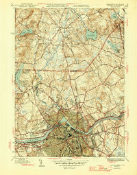
1946 Map of Lowell
USGS Topo · Published 1946About this map
The Merrimack River serves as the industrial and geographical anchor of this mid-1940s landscape, winding past the dense urban core of Lowell and its surrounding neighborhoods like Pawtucketville, Centralville, and Belvidere. The infrastructure of a textile-heavy economy is evident at the Lowell Textile Institute and the Filter Plant, while the Pawtucket Dam controls the river's flow near the city center. This period captures the city’s established educational and healthcare systems, featuring the State Teachers College and the Lowell General Hospital.
Find a feature on this map
75 named features on this map. Tap any name to fly to it.
Don’t see what you’re looking for? This feature index may not catch every label — zoom into the map to look around manually.
Map Details
Editions of this 1946 Lowell Map
2 editions found
Other maps of this area

1886 · Lawrence
USGS Topo · 1:62,500

1886 · Lowell
USGS Topo · 1:62,500

1888 · Haverhill
USGS Topo · 1:62,500

1888 · Lawrence
USGS Topo · 1:62,500

1890 · Haverhill
USGS Topo · 1:62,500

1893 · Lowell
USGS Topo · 1:62,500

1893 · Lawrence
USGS Topo · 1:62,500

1893 · Haverhill
USGS Topo · 1:62,500

1905 · Manchester
USGS Topo · 1:62,500

1918 · Lowell
USGS Topo · 1:62,500