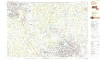
1987 Map of Lowell
USGS Topo · Published 1987About this map
The Merrimack River snakes through this 1980s landscape, anchoring the industrial and residential growth of Lowell and its surrounding townships across the New Hampshire Massachusetts border. This survey captures a transitional period of suburban development and civic expansion, visible in the cluster of institutions such as Lowell Tech Sch, Rivier College, and Lowell Gen Hosp. While the urban core of Lowell is densely packed, the map reveals the persistent rural character of the outlying areas, marked by numerous family-named corners like Perhams Four Corners, Frederick Corner, and Whidden Corner.
Find a feature on this map
127 named features on this map. Tap any name to fly to it.
Don’t see what you’re looking for? This feature index may not catch every label — zoom into the map to look around manually.
Map Details
Editions of this 1987 Lowell Map
2 editions found
Other maps of this area

1886 · Lawrence
USGS Topo · 1:62,500

1886 · Lowell
USGS Topo · 1:62,500

1888 · Haverhill
USGS Topo · 1:62,500

1888 · Lawrence
USGS Topo · 1:62,500

1890 · Haverhill
USGS Topo · 1:62,500

1893 · Lowell
USGS Topo · 1:62,500

1893 · Lawrence
USGS Topo · 1:62,500

1893 · Haverhill
USGS Topo · 1:62,500

1893 · Groton
USGS Topo · 1:62,500

1905 · Manchester
USGS Topo · 1:62,500